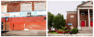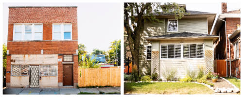
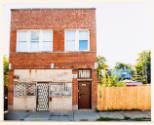

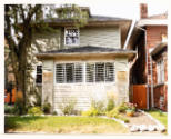
6720 S Ashland & 6720 N Ashland, from the series Folded Map™ Project
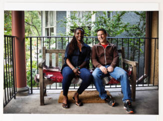
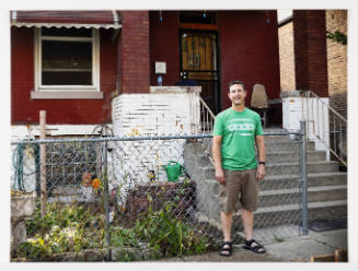
This work was part of Looking 101, a 2022 exhibition that supported Northwestern University’s undergraduate curriculum with an emphasis on first-year students. The following text was made available in the exhibition via cell phone camera (QR code) and booklet:
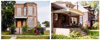
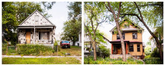
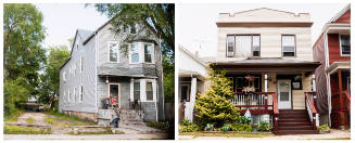
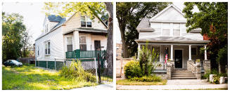
Organized by Chicago-based artist and activist Tonika Lewis Johnson, the Folded Map™ Project connects residents who live at corresponding addresses on the North and South Sides of Chicago, which she calls "address pairs." In this pair, the photograph of 6720 South Ashland Avenue shows a two-story building with a boarded-up commercial space at street level next to a vacant lot. The corresponding photograph of 6720 North Ashland Avenue shows a single-family house with a manicured front lawn. This series prompts viewers to consider the historical causes behind the discrepancies between Chicago’s North and South sides. Much of the city is divided by race, a fact that is in part the legacy of 20th-century redlining policies that denied home mortgages to African American applicants in certain neighborhoods, as well as the individual decisions of homeowners to reinforce segregation through individual actions. While the project started as a photographic study, it soon evolved into a multimedia exploration, with portraits and video interviews of residents as well as a stage play and an action kit. According to Johnson, the goal of the project is "to challenge everyone to think about how change may be possible and to contribute to a solution."