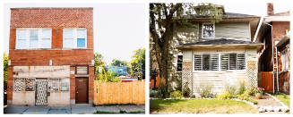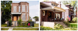

6329 S Paulina & 6330 N Paulina, from the series Folded Map™ Project
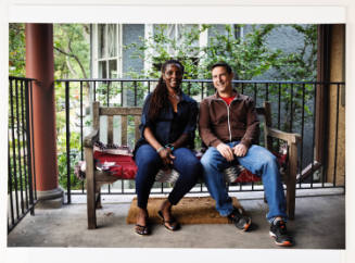
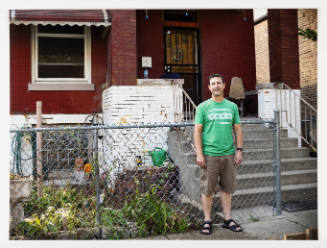
One Book One Northwestern, 2022–23
In her Folded Map™ Project, Tonika Lewis Johnson explores the legacy of segregation in Chicago through her documentation of “address pairs” — locations with corresponding addresses on the north and south sides of the city. In this pair, 6329 South Paulina shows a child riding a bike past a two-story brick flat with boarded up windows and an overgrown yard surrounded by vacant lots. At 6330 North Paulina is a brick house with a front porch decorated with furniture, a wreath, and a flag as well as a manicured lawn.
In viewing repetitions of discrepancies between blocks on Chicago’s north and south sides throughout this series, one begins to consider the historical causes of these differences. What Clint Smith calls the “fog of segregation,” which can color so many aspects of everyday life, becomes visible. Much of Chicago is divided by race, in part because of redlining policies, which denied mortgages for homes to African American applicants in certain neighborhoods, as well as the individual decisions of homeowners to reinforce segregation through individual actions. In How the Word Is Passed, Clint Smith points out that sometimes racism is discussed “as if segregation were completely natural, which absolves the enforcers of segregation—both systemic and interpersonal—from any sort of culpability.”